


Data and Mapping
Maintaining and contributing to many maps and databases, including a statewide GIS clearinghouse.
NHDES works diligently to provide easy access to quality geographic data and mapping tools through Geographic Information System (GIS), the Environmental Monitoring Database (EMD) and the New Hampshire Geological Survey (NHGS). GIS is a digital tool that uses geographic (spatial) data to display features. Environmental data is available through custom maps and applications, which allow users to find, explore and share data. The EMD stores a wide variety of data collected from state agencies, federal agencies, municipalities and volunteer groups that is then used internally and externally for assessments, research projects, statistical reports and more. NHGS maps the state’s bedrock, surficial deposits and mineral resources through its ongoing participation in the federal STATEMAP component of the National Cooperative Geologic Mapping Program. As official steward of the National Hydrography Dataset and Watershed Boundary Dataset for New Hampshire, NHGS maintains digital versions of the state’s surface water features and their drainage divides. NHDES partners with many state and federal agencies to maintain and contribute to many maps and databases, including the University of New Hampshire statewide GIS clearinghouse, NH GRANIT, and the U.S. Geological Survey.
Resources
GIS at NHDES
The NHDES Geodata Portal is the gateway to GIS data. Here you can find the online tools for accessing it.
OneStop Data Mapper
This user-friendly interactive mapper allows users to view, explore, filter and download NHDES OneStop data layers.
Coastal Viewer
The Coastal Viewer is an online mapping tool that brings spatial data sets within the state’s 42 coastal watershed communities together in one place. It’s hosted on NH GRANIT.
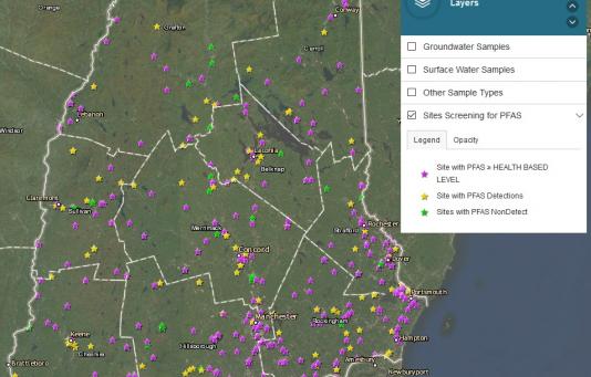
NHDES PFAS Sampling Map
This interactive map allows the user to access PFAS water quality data that exist in the NHDES Environmental Monitoring Database.
View the PFAS Map