


Tidal Stream Crossings
Assisting community officials in a strategic approach to tidal crossing infrastructure improvement and restoration.
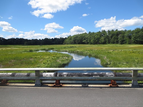 A tidal stream crossing (tidal crossing) is a bridge or culvert that conveys tidal flow below a traveled way, such as a road, pedestrian path, or railroad. When properly designed and maintained, tidal crossings can balance the needs of people and the environment by providing a functional, reliable and safe transportation network that supports the continuous movement of people, goods, and services across coastal communities while allowing adequate tidal flow to maintain healthy tidal marshes.
Resilient Tidal Crossings New Hampshire
In 2018, the NHDES Coastal Program and its partners assessed all known tidal crossings in New Hampshire's 17 coastal communities in accordance with the New Hampshire Tidal Crossing Assessment Protocol. Tidal crossing assessment data were used to rank and prioritize sites based on structure condition, flood risk and ecosystem health.
The Resilient Tidal Crossings NH Project was designed to better enable community officials and road managers to enact the strategic repair/replacement of tidal crossing infrastructure and to identify high priority restoration and conservation opportunities at tidal crossing sites.
Results of the project are available in a variety of formats:
Related Content

Prioritization Scores, Data and Summary Sheets
Tidal crossing prioritization scores, site data and tidal crossing summary sheets can be viewed through the NH Coastal Viewer. The entire tidal crossing database can be downloaded from the New Hampshire Statewide Asset Database Exchange (SADES).
Tools for Tidal Restriction Avoidance and Removal Webinar
On June 11, 2020, the New Hampshire Resilient Tidal Crossings Project was featured as the keynote presentation in the EPA Watershed Academy Webinar entitled: "Tidal Restriction Avoidance and Removal Webinar."
Assessment and prioritization of tidal crossing infrastructure
The final report "Resilient Tidal Crossings- An Assessment and Prioritization to Address New Hampshire's Tidal Crossing Infrastructure for Coastal Resilience" and associated appendices are available for download. If you have problems accessing any of these files, please contact us and we will provide accommodations.
Tidal Crossing Projects
Lubberland Creek Culvert Replacement, Newmarket
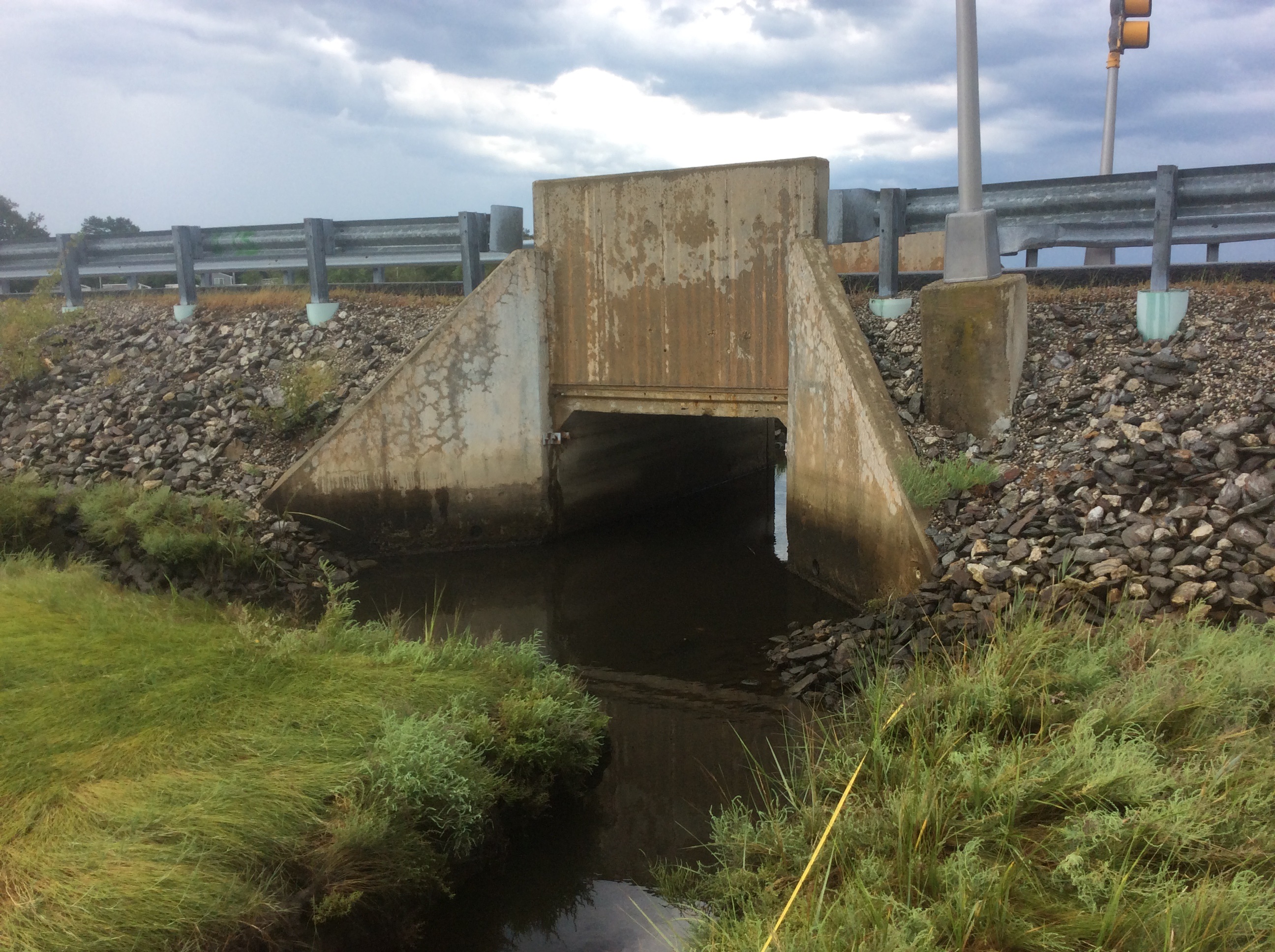
 In 2015, NHCP provided grant funding to The Nature Conservancy, in partnership with the town of Newmarket, to conduct topographic survey, hydrological and hydraulic analysis, geotechnical analysis and alternative analysis to develop engineering design drawings for the replacement of a severely undersized and perched culvert where Bay Road crosses Lubberland Creek in Newmarket. The assessment, prepared by Wright Pierce Engineers, recommended the replacement of the existing 3-foot round culvert with a 16-foot-wide and 9-foot-tall concrete box culvert, which is designed to accommodate the 100-year storm event while also accommodating predicted sea level rise. Installation of a new structure took place in 2019, thanks in part to a NHCP Coastal Resilience Grant. Read more: Project Portal: Lubberland Creek Culvert Restoration Story.
Philbrick Pond Drainage Evaluation, North Hampton
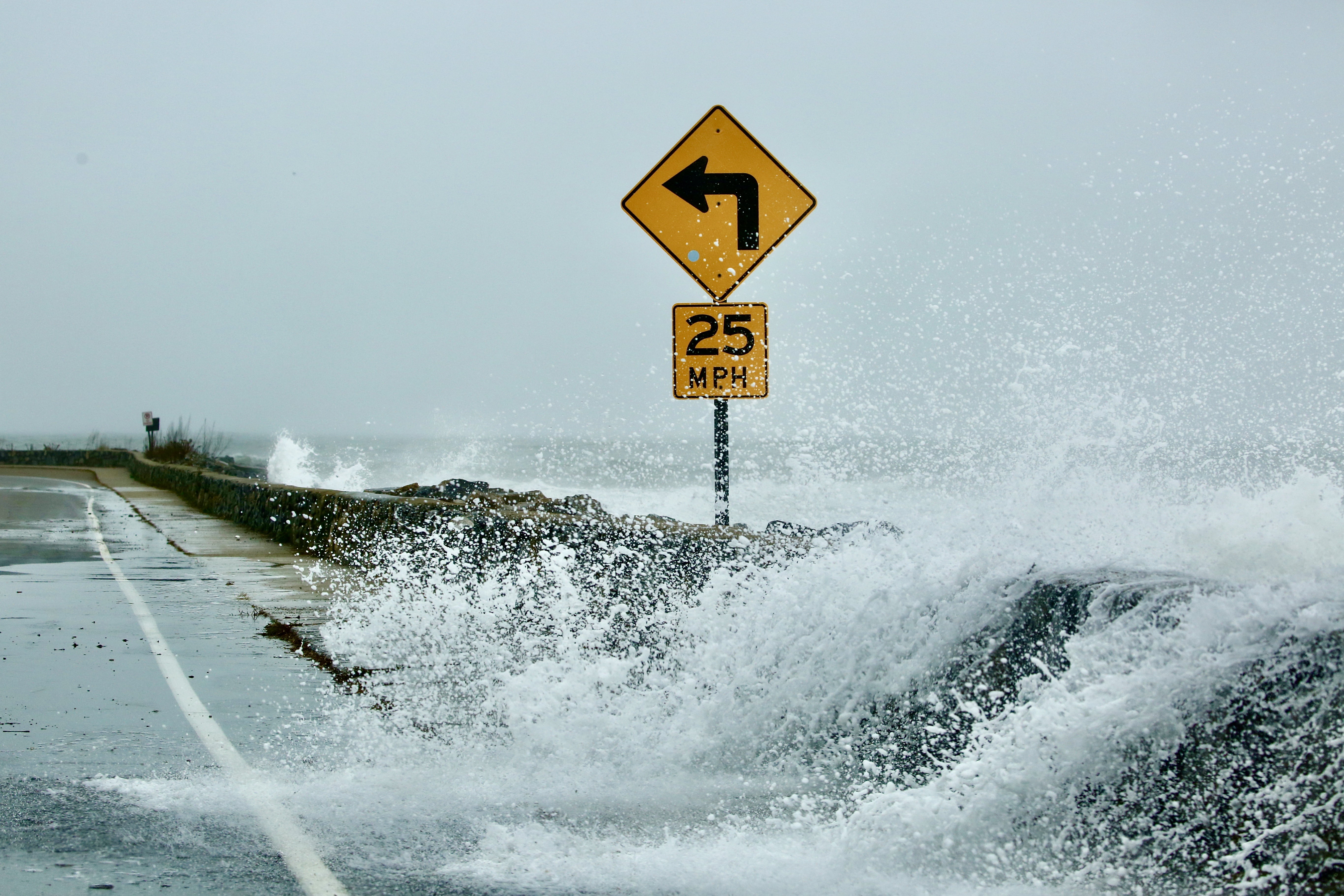
 Philbrick Pond is a 29-acre salt marsh system that drains a 1-square mile watershed to the Atlantic Ocean through two drainage structures, a culvert beneath Ocean Boulevard, US Route 1A, and a smaller culvert through a 1900 vintage trolley berm. In the 2006 Mothers Day Storm, drainage restrictions at these two culverts resulted in road flooding that isolated more than 40 homes from access by both personal and emergency vehicles for more than three days. In addition, the Philbrick Pond marsh vegetation has been noted by wetlands biologists for more than 30 years to be severely stressed due to poor drainage resulting in near-permanent inundation.
In 2015, NHCP provided grant funding to the town of North Hampton to conduct a detailed drainage analysis of the Philbrick Pond salt marsh. The "Philbrick Pond Salt Marsh Drainage Evaluation," prepared by CMA Engineers, describes the results of a complex hydrologic and hydraulic evaluation of the salt marsh during various tide cycles, precipitation events, storm surge, and predicted sea level rise. The report also describes the results of a variety of alternatives that were evaluated to improve drainage, reduce flood hazards and improve conditions of the Philbrick Pond salt marsh. Read more: Project Portal: Philbrick Pond Salt Marsh Drainage Evaluation Story.