

New Hampshire Marsh Monitors: Evaluating Change in Our Salt Marshes
There are over 6,000 acres of salt marsh within New Hampshire. These ecosystems serve as home to a diversity of wildlife and fish, offer aesthetic and recreational benefits, and provide important ecosystem services such as carbon storage and flood attenuation. Unfortunately, human impacts related to salt marsh farming, mosquito control and encroachment from development threaten the sensitive balance of coastal marshes. Additionally, accelerated sea level rise is predicted to cause significant impacts to salt marshes, with some models predicting up to 90% loss of New Hampshire salt marsh by 2100. Understanding how these unique wetlands respond to human modifications and sea level rise is an important objective of the NHDES Coastal Program.
Between 1995 and 2005, New Hampshire partners implemented 32 salt marsh restoration projects, which focused on removal of tidal restrictions, removal of fill, and creation of additional open water habitat. During this nearly 10-year period, the Marsh Monitors, a volunteer program led by the Coastal Program, was enacted to assess marsh conditions and ecosystem response to restoration over time.
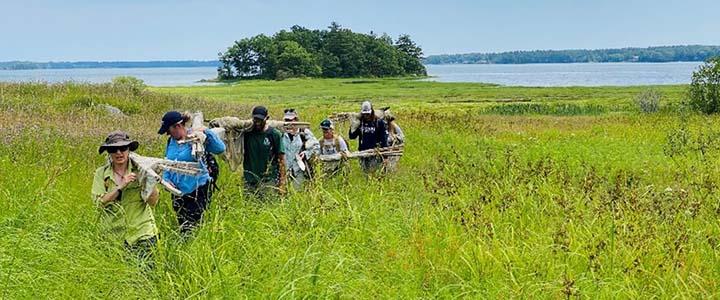
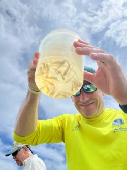
Over 15 years later, the Coastal Program returned to five marsh sites in the summer of 2022 to collect data on vegetation, porewater salinity, and nekton (fish, crabs and shrimp). By revisiting previous Marsh Monitors sampling locations, the program can assess current marsh conditions and habitat, as well as the lasting impacts and effectiveness of previous restoration activities.
The Marsh Monitors Program will continue for the 2023 field season and beyond to revisit and monitor additional New Hampshire marshes that were previously restored or served as reference sites. Consecutive years of data helps us to understand annual variability in these shifting systems and better characterize overall marsh health. New methods have been added to protocol, including fixed photo stations and computer analysis of how the landscape has changed over time using aerial imagery.
In addition to restoration monitoring, the Coastal Program is working with the Great Bay National Estuarine Reserve to institute additional long-term trend monitoring stations. These monitoring sites will quantify plant community change at the transition areas from the low elevation marsh to the higher upland forests or fields to identify how marshes may be migrating landward as sea levels rise. This assemblage of monitoring data will allow us and our partners to identify and prioritize at-risk marshes that may be eligible for future restoration intervention.
The Coastal Program plans to hire two summer interns in 2023 to assist with marsh monitoring efforts. If you are interested in volunteering or want to learn more about the program, please contact Aidan Barry at aidan.t.barry@des.nh.gov.