

Coastal Hazards and Adaptation
Using the best available science to avoid and adapt to coastal hazards.
 Proactive planning and action are essential to ensure that coastal New Hampshire can mitigate and adapt to worsening coastal flood hazards, such as sea-level rise, coastal storms and extreme precipitation. Through technical assistance and partnerships, the Coastal Program and the Air Resources Division assist state and local decision-makers with adaptation and resilience planning to minimize damage and increase preparedness and resilience.
In 2019, NHDES convened a Science and Technical Advisory Panel (STAP) Steering Committee comprised of representatives from multiple state agencies to update coastal flood risk projections and guidance related to relative sea-level rise, coastal storms, groundwater rise, extreme precipitation and freshwater flooding. The five-year update of the 2014 report, “Sea-Level Rise, Storm Surges, and Extreme Precipitation in Coastal New Hampshire: Analysis of Past and Projected Future Trends,” is mandated by RSA 483-B:22. The New Hampshire Coastal Flood Risk Summary update is comprised of two parts: a summary of best available science (Part I) and guidance for how to use the science in decision-making (Part II). Read more about the NH Coastal Flood Risk Summary Update.
The New Hampshire Coastal Program (NHCP) works with several agencies, collaborations and nonprofits to advance coastal resilience with programs and tools. One group NHCP partners with is the New Hampshire Coastal Adaptation Workgroup (NHCAW), which is a collaboration of more than 25 organizations. Examples of past projects with NHCAW are Setting SAIL, which provided outreach and technical assistance to support implementation of the 2014 NHCRHC final report, and Climate Risk in the Seacoast.
Tools and Data
More Resources
Coastal Resilience Grants
To help communities prepare for current and future coastal hazards, the New Hampshire Coastal Program administers the Coastal Resilience Grant (CRG) program, which provides competitive funding for coastal community and habitat resilience projects.
Spotlights
VIEW ALL SPOTLIGHTS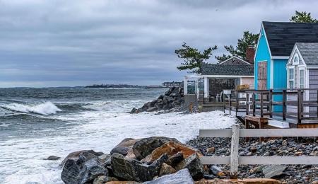
Coastal Landowner Technical Assistance Program
The Coastal Landowner Technical Assistance Program (LTAP) is a partnership program between NHDES and the University of New Hampshire to provide consistent assistance to interested coastal landowners to help understand coastal flood and erosion risks and restoration opportunities, clarify goals for managing their property, and identify conceptual options that may enhance the resilience of their properties, neighborhoods and community's natural resources. LTAP provides site visits to participating properties along with targeted risk assessment and guidance information. If you are a coastal landowner interested in learning more about how to manage flooding or erosion on your property, please contact us!
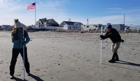
Volunteer Beach Profile Monitoring Program
The goal of the New Hampshire Volunteer Beach Profile Monitoring Program is to train and mobilize volunteers to collect measurements of beach surface elevations along New Hampshire’s Atlantic coast. The data collected provide an increased understanding of beach responses to storms as well as seasonal and long-term trends of erosion and accretion. Results will provide municipal and state decision-makers with important information on coastal processes for guiding beach management as well as inform storm surge forecasting models currently in development by the National Weather Service.
Hampton Coastal Hazards and Adaptation Team
The Coastal Program works with the Seabrook Hamptons Estuary Alliance to support the Hampton Coastal Hazards and Adaptation Team (CHAT). CHAT is comprised of members of the Hampton municipal boards, commissions and paid staff. The group meets regularly to improve coordination as the town plans for community-wide adaptation to coastal flooding.
Coastal Hazards and Adaptation Master Plan Chapters
The Coastal Program supports the integration of future coastal flood risks in municipal master plans and other state and local planning efforts, often in partnership with the Strafford and Rockingham Regional Planning Commissions. With Coastal Program and National Oceanic and Atmospheric Administration support, the towns of Durham, Hampton, North Hampton, as well as the Little Boar’s Head Village District are adding important information about coastal hazards and priority adaptation actions in updates to their master plans.
Seacoast Transportation Corridor Vulnerability Assessment and Plan
The Coastal Program is partnering with the Rockingham Planning Commission, the NH Department of Transportation and coastal municipalities to enhance regional coordination for transportation networks vulnerable to sea-level rise and other coastal hazards in order to maximize information sharing, identify opportunities to fill data gaps and develop shared understanding of options for future transportation planning.
Additional Resilience Resources and Past Projects:
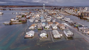
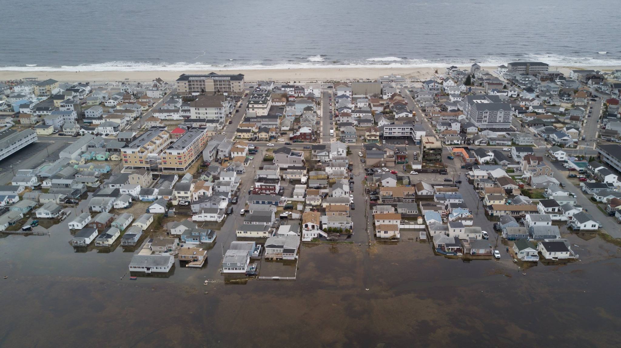
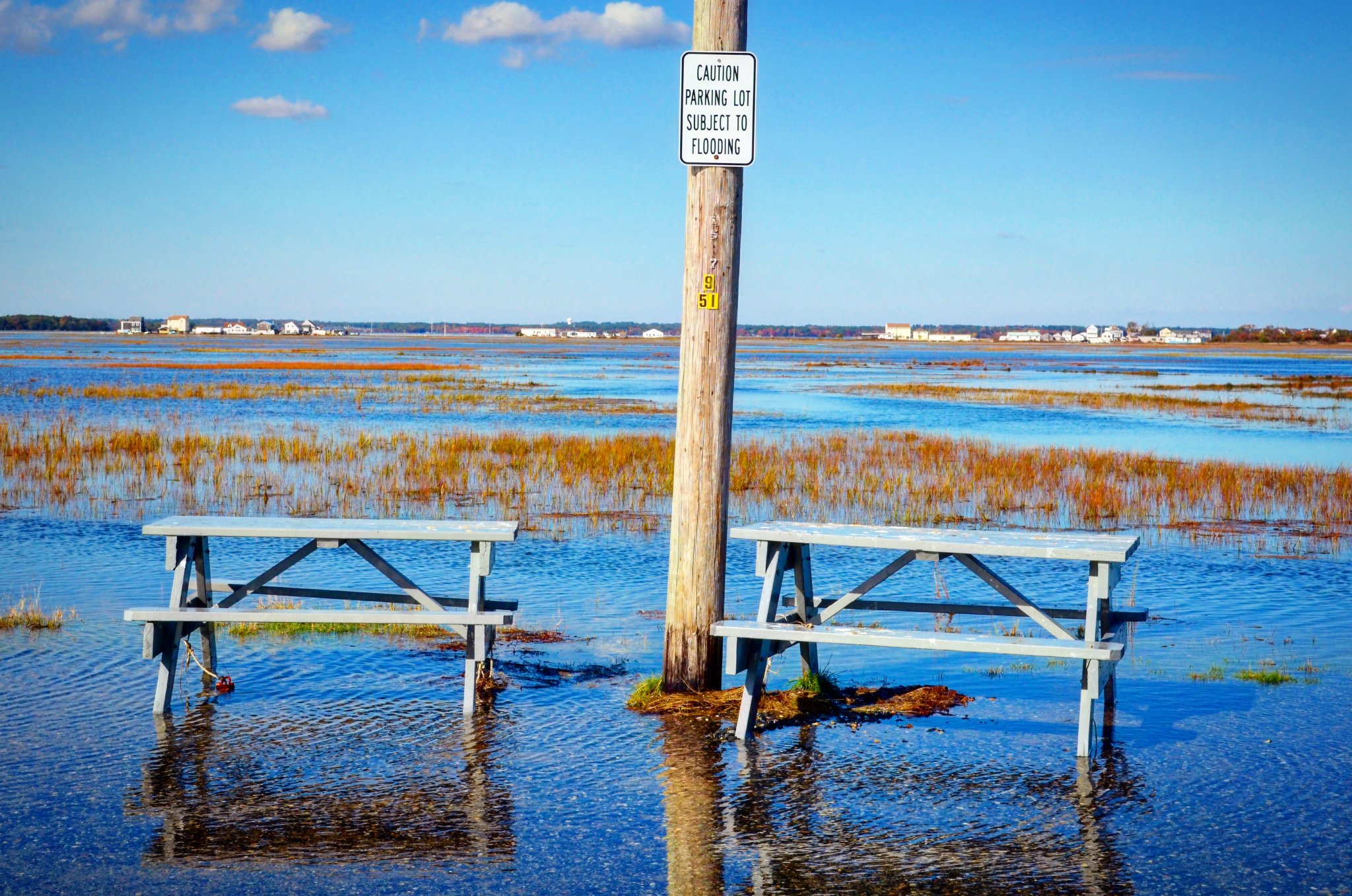
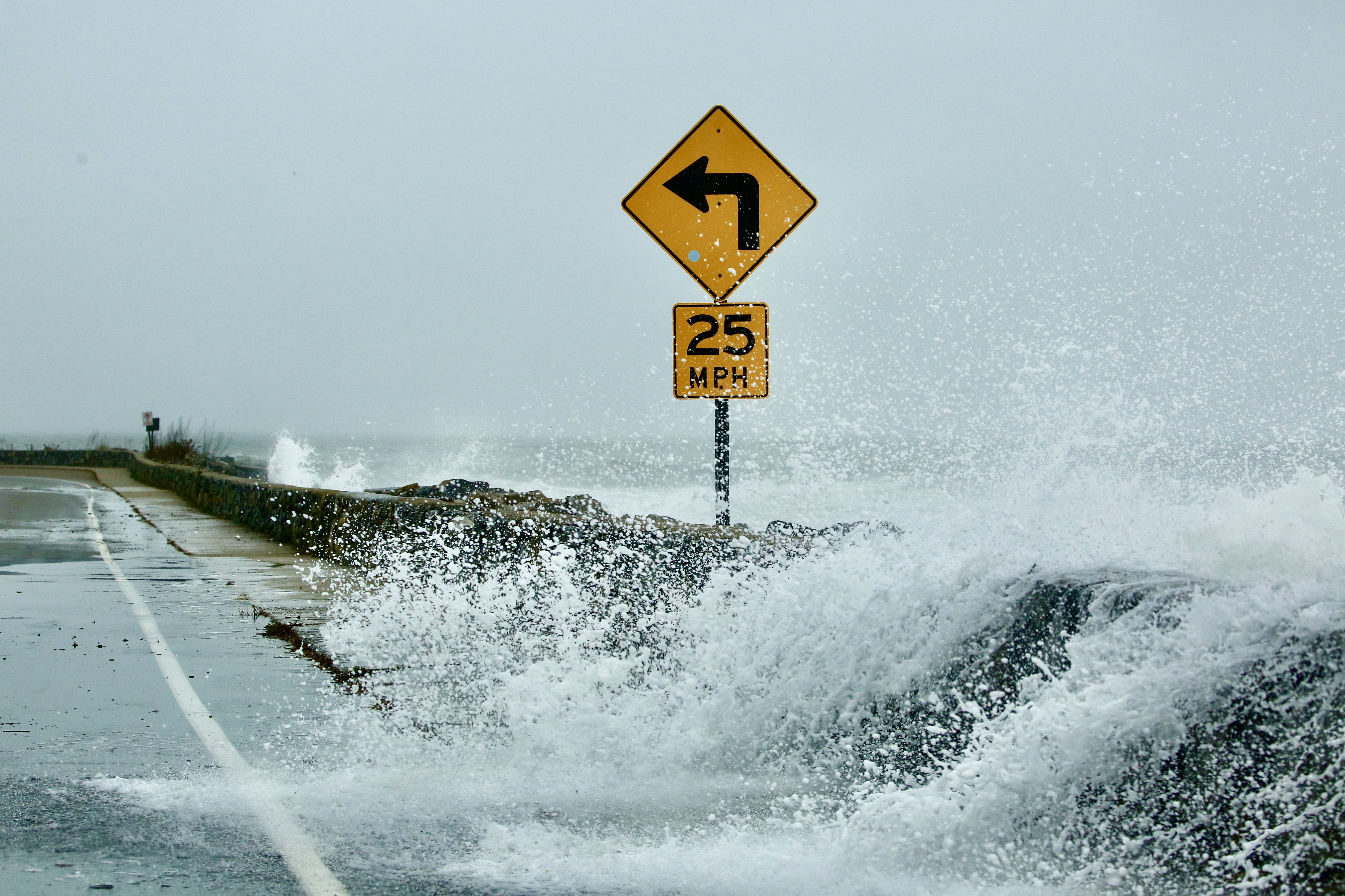
Rising Tides Photo Contest
The New Hampshire Coastal Adaptation Workgroup's annual photo contest aims to raise awareness about sea-level rise and the increasing frequency of high tide flooding in New Hampshire. Photographing today's higher than normal tides offers a glimpse of what daily water levels could be like in the future as sea levels rise.